
Jacksonville Street Directory Steps
An address-led Jacksonville street directory search begins with the address itself, not a person’s name. Normalize the street and ZIP with USPS, then use Onslow GIS to locate the physical parcel. The map record can supply the PIN or PARID, current deed book and page, legal description, city or ETJ context, and the address shown on the parcel. Follow that with the tax record, which provides a separate current property path. Those records can identify an owner or recorded transaction, but neither proves that an owner, tax correspondent, or listed voter currently lives at the location.
- Enter the full physical address in the Onslow GIS Parcel Viewer and save the parcel identifiers, situs address, current deed book/page, and jurisdiction layers.
- Run the street through Onslow Tax / Property Search. Its address mode separates house number, street name, and street type, with Exact, Begins With, and Contains choices.
- Open the current instrument through the Onslow Register of Deeds index or the active PropertyCheck route. Read the legal description and the prior instrument named in the deed.
- Use the official voter lookup only for public fields that are returned, then preserve status and privacy limits. Registration is not title and does not establish every person in a household.
- For an earlier household, check the Tucker Littleton Room’s dated directories and telephone books. The historical address sequence is evidence for that edition, not a present-day roster.
That sequence keeps the street-by-street work reproducible. It also leaves a clear path when one portal lacks an old image: use the deed book/page at the Register of Deeds counter, library microfilm, or a targeted request for an existing record rather than asking an agency to create a custom street list.
Jacksonville Streets in Tax Search
Onslow Tax / Property Search is the fastest first pass for address research because it accepts an address split into its parts. No basic field is required by the help page, but the user chooses an owner, parcel, address, or map search method before continuing. A street-name and street-type search can return multiple addresses, which is useful when a house number is unknown. Results are sorted by owner for the basic modes. Treat that sort order as an assessment record, not a list of occupants.
| Tax Search Field | Input | Street-use note |
|---|---|---|
| Property Owner Name | Last first, separated by a space | Useful after an address result identifies an owner. |
| Parcel Number | Full or beginning value | Connects the tax record to the GIS parcel. |
| Property Address | House number, street name, and type | Use Exact, Begins With, or Contains for a street run. |
| Street Type | Displayed dropdown choice | Helps distinguish similar street names. |
| Map Number | Complete or beginning value | Dashes and periods matter in this field. |
The county’s Tax Search help shows the field layout used for a Jacksonville address search.
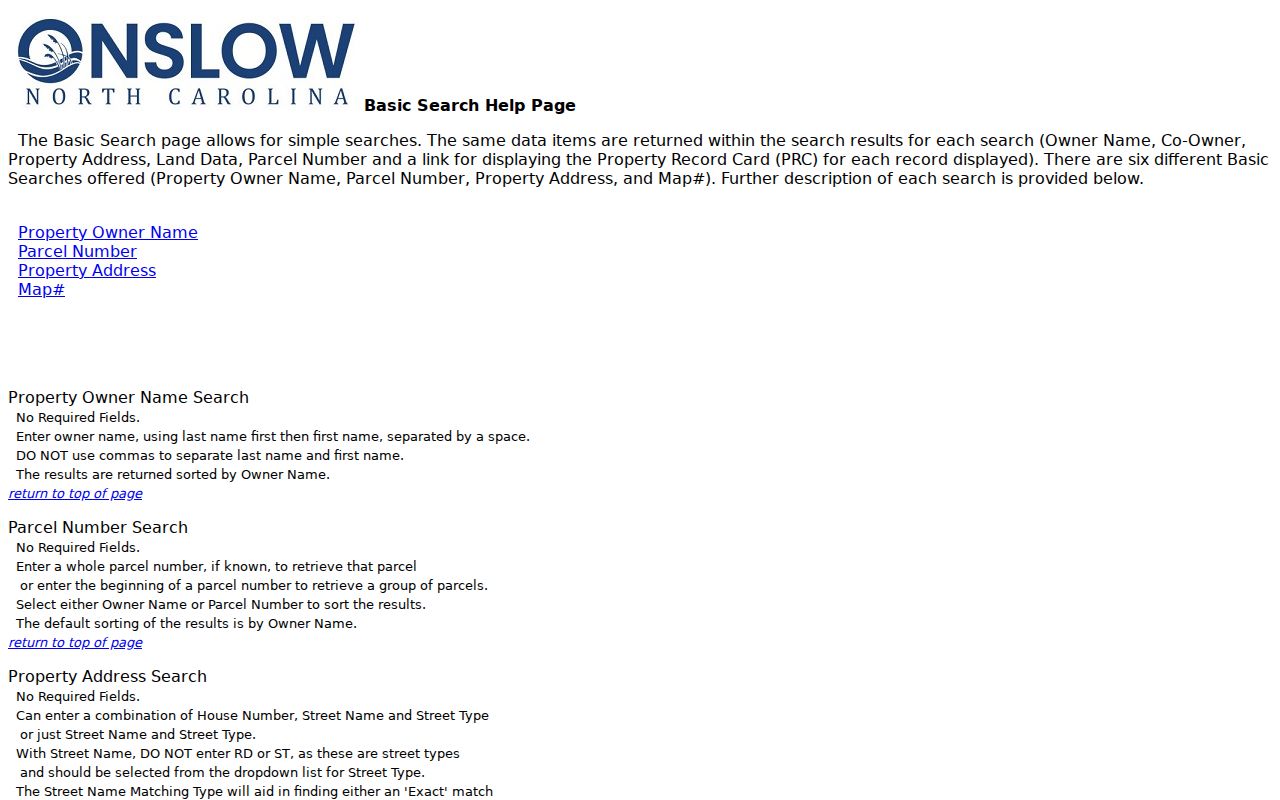
Separating street components reduces false matches and makes the next GIS or deed lookup easier to repeat.
Map a Jacksonville Street Parcel
The GIS viewer adds details that the tax page does not present in the same way. Search modes include Owner Name, Parcel ID, NCPIN, and Property Address. Owner-name format is last,first with no space after the comma, while the Tax Search help uses a last-first format with a space and no comma. Property Address uses the PHYSICAL_ADDRESS attribute and a contained match. Current deed book/page is searchable too. This small format difference is worth checking before deciding a person or parcel is missing.
Open the selected parcel and compare physical address, PIN or NCPIN, PARID, legal description, owner mailing address, sales, map geometry, township, zoning, and city or ETJ layers. GIS also carries centerlines, ZIP polygons, flood zones, wetlands, neighborhoods, and future land-use layers. Parcel lines are compiled from deeds and plats, so the viewer is a research aid, not a legal survey.
Onslow GIS downloads display separate address, parcel, and boundary layers with their own update dates.
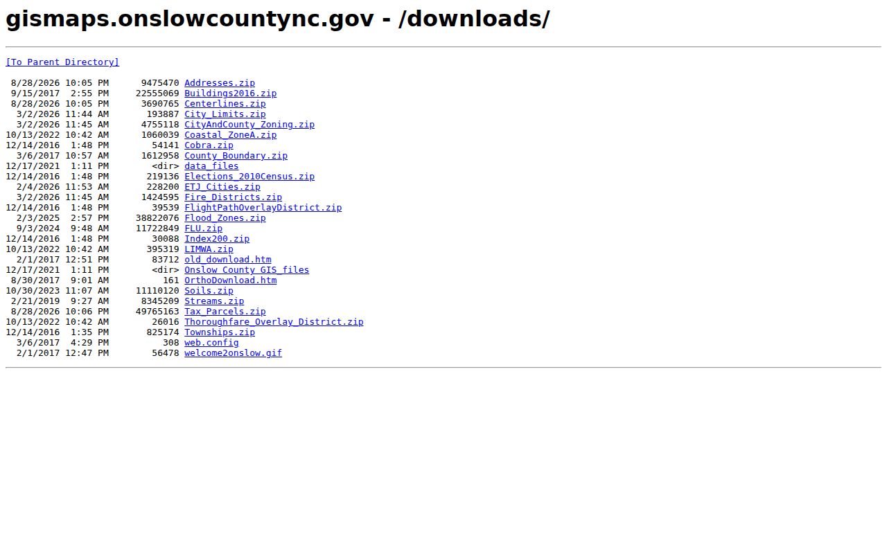
Use the layer date that belongs to the feature being checked. A parcel layer’s date does not make flood, zoning, or address data current on the same schedule.
Jacksonville Address Records Compared
Jacksonville street-by-street research is a chain of different address-keyed records, not a single public roll. Each source answers a narrower question. The parcel and tax records are strongest for assessment and ownership context. The deed instrument records a legal transfer. A directory can put a named householder at an address for one printed edition. Municipal forms may tie an address to a request or project, but they should not be used to republish a complainant’s contact details.
| Address record | Custodian | What it can establish | Access route |
|---|---|---|---|
| Tax/property roll | Onslow Tax Office | Owner field, mailing address, parcel, values, and situs | Tax Search, tax bill search, taxpayer portal |
| Parcel map | Onslow GIS | Geometry, PIN, PARID, current deed reference, layers | Web viewer, downloads, selected-row CSV export |
| Recorded instrument | Onslow County Register of Deeds | Grantor, grantee, date, book/page, legal description | Index, PropertyCheck, counter, mail, library fallback |
| Public voter record | N.C. State Board of Elections / Onslow BOE | Returned registration and district fields | Lookup, weekly data, targeted existing-record request |
| City address form | Jacksonville city department | Location and routing for a documented municipal matter | City form or the correct city/county office |
North Carolina Public Records Law, N.C. Gen. Stat. Ch. 132, permits inspection and copying of public records at reasonable times, but it does not require an office to compile a new Jacksonville street roster on request. Name the existing record, office, date range, address or parcel, and preferred format when a portal does not carry the needed item.
Jacksonville Deeds Along a Street
The Register of Deeds turns a present parcel into a title trail. The county reports deed books from 1734 to the present, while the observed certified-date windows are narrower: consolidated real property from 1995 through the observed 2026 date, and pre-95 real estate from 1977 through 1994. Search modes include Indexed Records, Quick Name, Advanced Name, Property, Book/Page Number, File Number, Date Range, Pre-1976 Dates, and Certified Dates. When the online trail ends, the appropriate next stop may be the pre-1976 path, a book/page search, the ROD counter, the State Archives, or library microfilm.
- Parcel
- A mapped unit of land used to connect a physical address with tax and GIS records.
- Situs address
- The physical location of the parcel. It can differ from the owner’s tax mailing address.
- Plat
- A recorded map of lots, boundaries, or subdivisions. It helps explain land configuration but does not replace a survey.
- Criss-cross directory
- An address-order directory. Jacksonville’s documented substitute is the 1960 householder section, not a separately confirmed reverse-directory run.
The Onslow County Register of Deeds office page identifies the custodian, record categories, phone route, and counter hours.
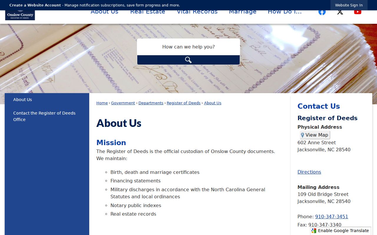
The counter and telephone route are the useful fallback when a legacy portal changes or an older image is not available online.
Jacksonville Street Buffer Tools
For a block segment, start in GIS rather than searching one owner name. Choose the parcel, open Tools, use Select by Location, enter a buffer distance in feet, and use Zoom To. The selection can identify nearby parcel polygons and then export selected rows through the CSV or Excel icon. The viewer caps a selection at 2,500 features. A road, river, or unplatted strip can separate nearby parcels, so pan and re-run the selection where the map geometry calls for it.
The street-centerline tool and contained physical-address search are better for working the length of a Jacksonville street. Add ZIP, city-limit, ETJ, township, and zoning layers before assuming that a Jacksonville mailing label identifies the governing city office. City violation reports, for example, are expressly limited to city limits and ETJ, with other matters routed to the county or another municipality.
Jacksonville’s Report a Violation form illustrates the city’s location fields and city/ETJ boundary notice.
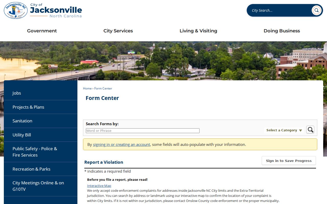
An address in a municipal form is a routing fact for that report. It is not a public statement about who occupies the parcel.
Jacksonville Street Research Insider Tip
The strongest documented historical street tool is the 1960 Hill directory’s householder department. It places numbered and named streets in address order, puts names opposite addresses, and includes intersecting streets, occupancy-status notation, and telephone numbers where printed. It is not proof of every resident or a complete reverse directory, but it can anchor a Jacksonville address to one edition. The Tucker Littleton Room holds city directories from 1960 to 2019, telephone books from 1957 to the present, and local newspapers from 1938 to the present.
Insider tip. Use the 1960 householder section as the documented Jacksonville address-order substitute, then confirm a name with the deed chain, census, or newspaper for the same period.
For the collections, edition details, and how a printed entry is structured, use the Jacksonville city directories resource. A historical street entry should retain its printed spelling, edition year, and page reference, especially where older street descriptions do not resemble a current subdivision address.
Jacksonville Street Boundaries Matter
Postal and government boundaries often diverge around Jacksonville. USPS has address, city-and-state, and city-by-ZIP lookup paths, but a ZIP result does not confirm that a person or company is at an address. The core Jacksonville postal ZIPs are 28540, 28541, and 28546. Other Jacksonville-associated labels may involve Camp Lejeune or nearby installation geography. The GIS ZIP, city-limit, ETJ, county, and township layers are the practical check before choosing an office or interpreting a record.
North Carolina’s address records can therefore show a Jacksonville mailing city for a parcel outside the incorporated city, or a military postal association near federal land. Preserve the physical address, parcel identifiers, and map jurisdiction instead of reducing each result to one city label.
Note: The map’s city-limit and ZIP layers answer different questions, so compare both before assigning a street record to a municipal department.
Jacksonville Street Deed Alerts
Onslow’s PropertyCheck migration is useful as an alert layer for a name connected with a recorded real-estate document. It is not a title opinion and it does not prevent a questionable recording. The Sheriff’s vacant-lot fraud warning stressed that alerts arrive after recording. For a suspicious transfer, compare the legal description, grantor identity, and prior instrument, then contact the Register of Deeds or law enforcement through official channels. Do not rely on a caller’s phone number or a copied screen alone.
PropertyCheck is the current route named in the ROD migration notice.
Use an alert to prompt a record check, then verify the instrument through the custodian and preserve its book/page or document number.
Jacksonville Address Occupancy Myth
Myth: A tax mailing address, voter registration address, or USPS result proves who occupies a parcel. Each has a different purpose, so none should be treated as occupancy proof by itself. A mailing address is tax correspondence. A public registration is not title. A USPS result only standardizes a delivery address. Compare dated directories, deed records, and other appropriate evidence before drawing a narrow historical conclusion.
Jacksonville Street Research Limits
No Jacksonville street-search result can establish a complete household list. Owner mailing addresses may be outside the county or state. A situs address shows parcel location, not occupancy. Directory entries are dated editorial snapshots. Voter results carry protected-address and status limits. North Carolina law also restricts birth data, Social Security numbers, driver-license numbers, adoption material, protected voter addresses, and other confidential records. A name match remains a lead until independent fields support it.
Lawful use. Jacksonville street and parcel records are for personal, lawful research and civic reference. Never use an address trail to stalk, harass, intimidate, or harm another person.